Coastal environmental monitoring solution using satellite imagery
Littosat is a comprehensive monitoring solution that that converts optical satellite imagery into actionable insights about coastal environments. This data enables monitoring of, for example, intertidal vegetation, turbidity, shallow-water bathymetry, and algal bloom-related phenomena.
More than just a visualization tool, Littosat is a comprehensive infrastructure that combines the collection, processing, analysis, visualization, and distribution of satellite data tailored to business and operational needs.
Thanks to reliable, certified satellite products, automated API services and GIS and web interfaces, Littosat facilitates data access for public agencies as well as private entities such as consulting firms specializing in the environment or aquaculture.
Littosat-data | Distribution of satellite mapping products
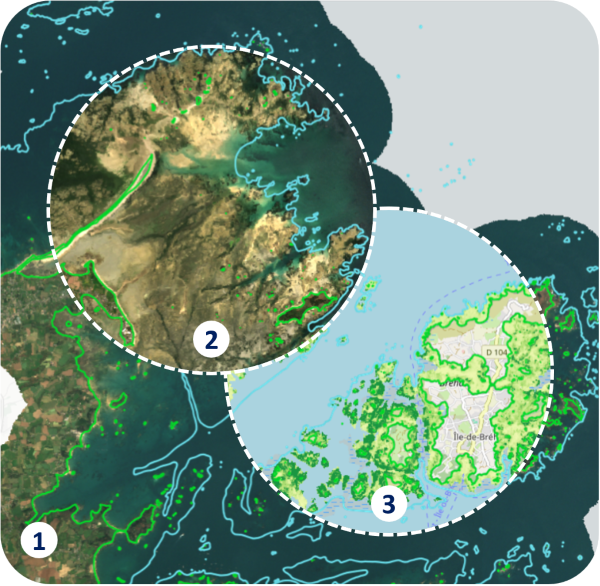
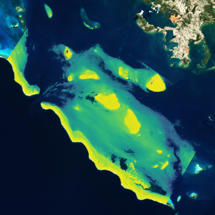
Example: Foreshore of the Sillon de Talbert and Ile de Bréhat nature reserves, Brittany, France, Spring 2022
1 : tidal-S2
high tide
2 : tidal-S2 low tide showing the foreshore
3 : ivi-S2 low tide revealing the vegetation cover of the foreshore (vegetation shown in dark green, areas without vegetation in light green)
©
Hytech-imaging, contains modified Copernicus Sentinel data
Littosat-data offers a range of cartographic data layers derived from satellite imagery, such as Sentinel-2 (S2) images with 10-meter resolution, covering coastal areas over several years:
Sentinel-2 image mosaics at different tidal levels | 2018–2024 seasonal monitoring of the English Channel, North Sea, and Atlantic coasts is now available
Emerged foreshore vegetation index | 2018–2024 seasonal monitoring data for the English Channel, North Sea, and Atlantic coasts is now available
Inter- and intra-annual variation in the ivi-S2 vegetation index | 2018–2024 seasonal monitoring of the English Channel, North Sea, and Atlantic coasts is now available
Shallow-water depth and topography | On-demand production and national coverage 2026 coming soon
Digital elevation models (DEMs) of the intertidal zone | On-demand production and large-scale demo in 2026, coming soon
Chlorophyll content | On-demand production and 2026 large-scale demo coming soon
Turbidity and suspended Matter | On-demand production and 2026 large-scale demo coming soon
These products are available upon request in various formats, including downloads in GeoTIFF format or via standard OGC/INSPIRE geoservices, and can be used directly in your GIS systems or within the Littosat-Viewer interface (see the next section). For more information, please contact us.
Littosat-viewer | A simple and user-friendly visualization service
Littosat-viewer is an intuitive GIS web interface designed to facilitate access to Littosat-data mapping products. It is intended to integrate all information layers (bathymetry, vegetation, water quality) and currently provides:
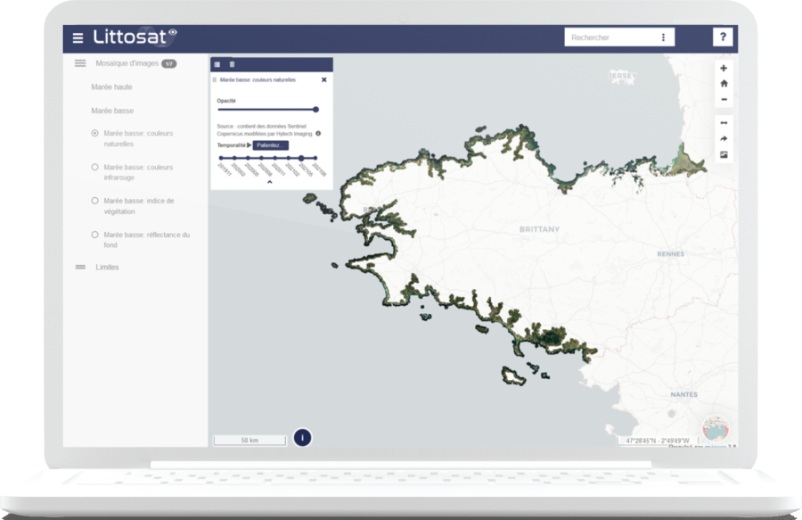
The viewer is a practical component of Littosat, but the complete solution also includes mapping products, processing pipelines, and APIs for operational data utilization.
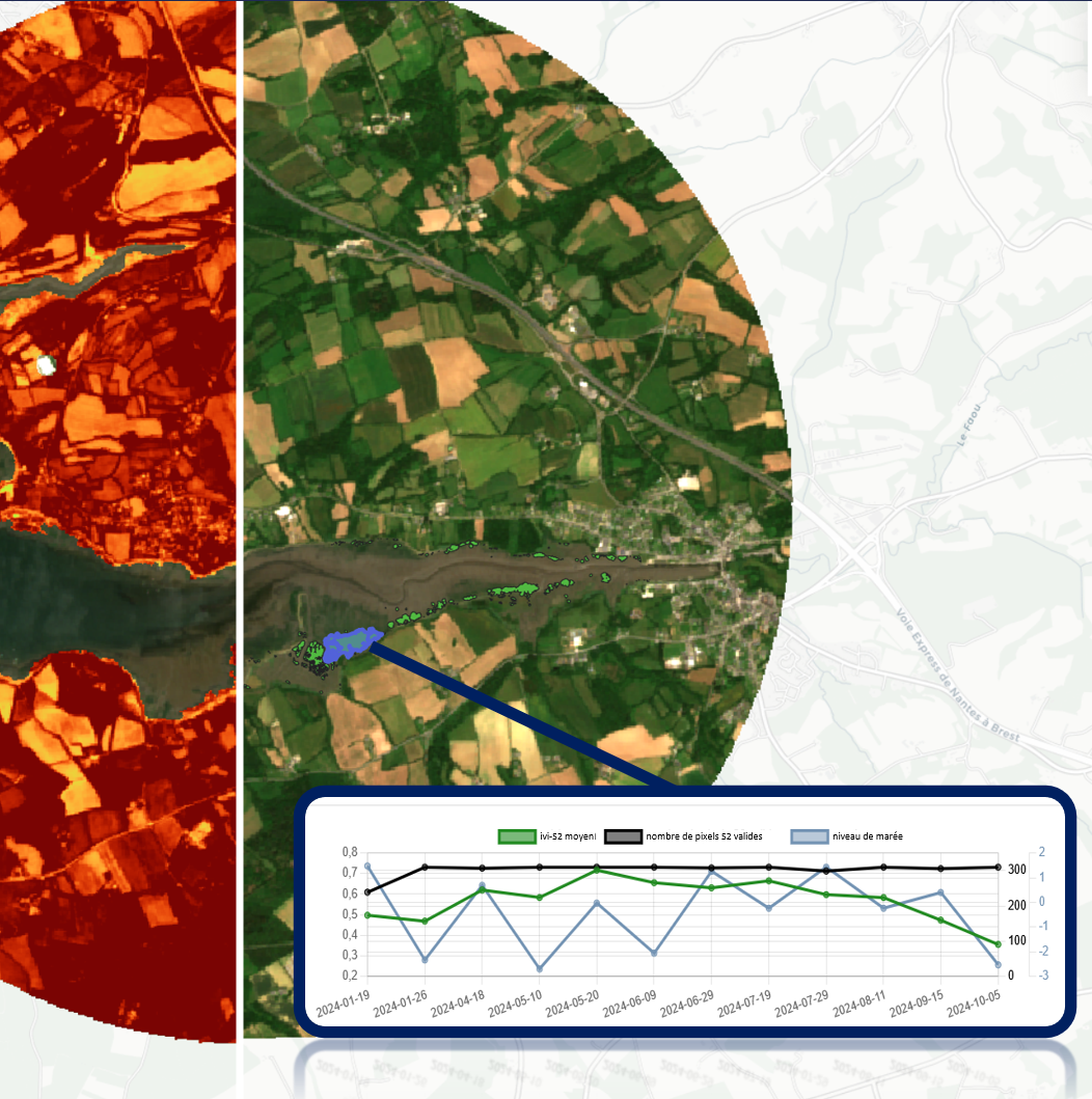
It is already deployed in Brittany, distributing seasonal tidal-S2 and ivi-S2 data covering seven years since 2018; and along the English Channel, North Sea, and Atlantic coasts, distributing seasonal tidal-S2 and ivi-S2 data for two reference years (2018 and 2024).
Littosat-processing-hub | Access to image selection and processing capabilities
Littosat offers a complete API infrastructure, giving you access to image selection and processing capabilities tailored to the coastal environment. The API offerings currently available include:
Grâce aux API, les utilisateurs peuvent exploiter Littosat de manière flexible et automatisée, tout en conservant la qualité et la cohérence des produits satellitaires. Ces API sont disponibles à la demande, pour en savoir plus, contactez nous.
Uses
Littosat enables the conversion of satellite data into actionable information for coastal and marine environmental monitoring. These applications are being implemented in pilot regions in France and around the world.
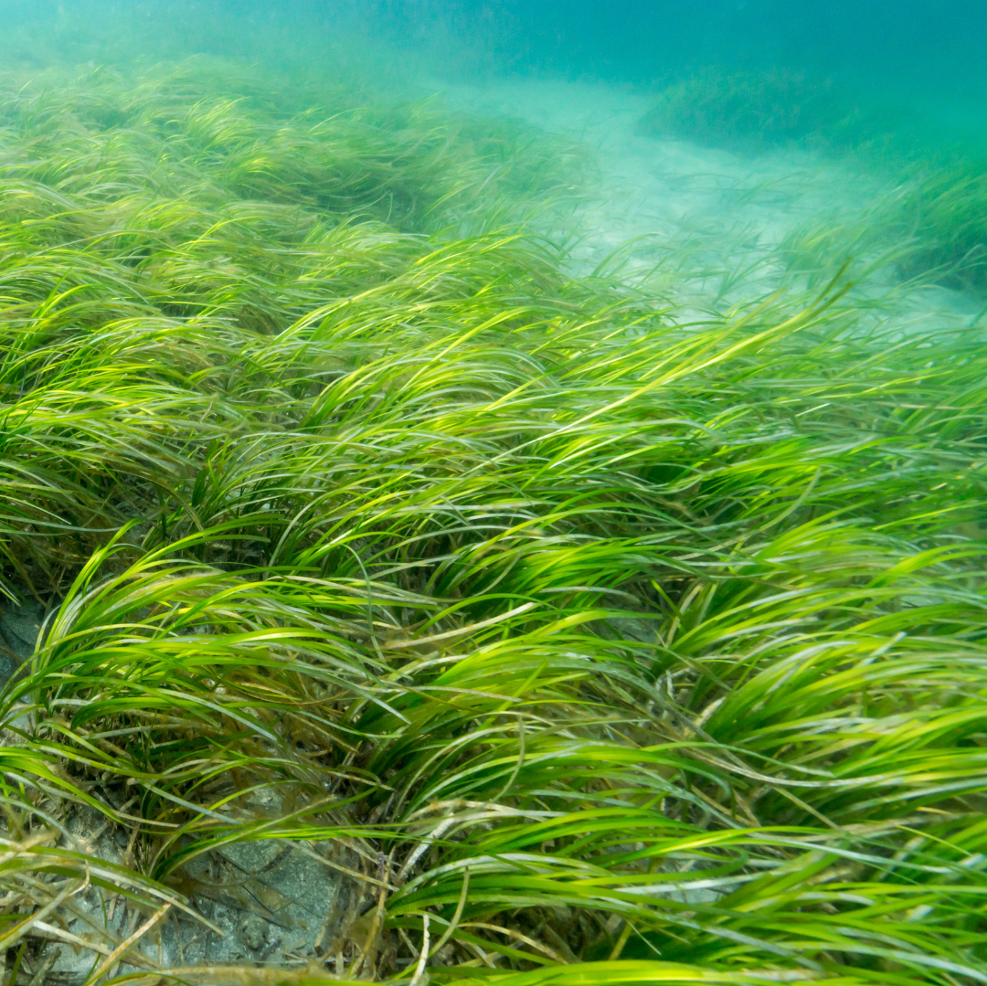
Coastal biodiversity
Monitoring of coastal habitats (intertidal and shallow-water) and their changes
Coastal morphodynamics
Monitoring changes in intertidal and subtidal zones
Coastal water quality
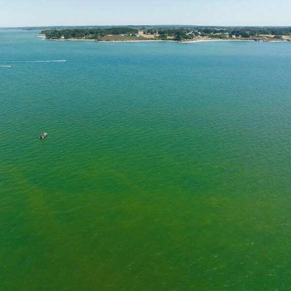
Monitoring of turbidity and algal blooms
Support for the management of marine protected areas
Operational indicators to support management decisions
Early adopters
Brittany
(France )
Gulf of Lion
(Pyrénées Orientales and Aude, France)
Channel Sea
(Normandie and Hauts-de-France, France)
Bay of Brest
(Finistère, France)
Iroise Sea
(Finistère, France)
South Africa
(Selection of pilot sites is currently on-going)
Collaborative approach
Littosat relies on institutional and scientific partners who contribute both to the technical innovation of the Littosat solution (for example, by supporting the development of data processing pipelines) and to user-centric innovation (for example, by integrating scientific and domain expertise, and by co-developing dashboards and API services).
CNES is supporting Littosat through various initiatives (R&T, SCO, the France 2030 Space Component).
The Space for Climate Observatory (SCO) has certified two projects to roll out the platform in France and internationally
The Bathysat solution was developed for the Shom as part of an innovation partnership.
The OFB is participating in a working group that aims to assess the contribution of satellite data to biodiversity monitoring policies.
The CMEMS contributed to the extension of Littosat to the English Channel and Atlantic coast through a call for proposals Coastal & Arctic Hubs Uptake.
The Defense Innovation Agency supports the development of Bathysat.
IRISPACE supports Littosat through its Copernicus Regional platform.
The Pôle Mer is supporting Hytech-imaging in the development of its coastal services (events, certification, etc.).
Workflow processes that ensure the reliability of cartographic products
Littosat cartographic data is generated by our processing chains, which have been co-developed and validated with leading scientific and institutional partners, ensuring their reliability and operational relevance.
Bathysat© is an automated or semi-automated production chain for generating certified bathymetric data for coastal areas using multispectral imagery. It was developed for the French Hydrographic Office Shom as part of an innovation partnership beginning in 2019, making Bathysat France’s satellite bathymetry system.
Secchisat© is a data processing system for generating turbidity and suspended sediment data based on the measurement of diffuse attenuation parameters in the water column. It was developed in partnership with the French Hydrographic Office Shom. Secchisat is used to generate data for monitoring, climatology, and turbidity forecasting in coastal and offshore areas.
Chlorosat© is a processing pipeline that enables the early detection of microalgal blooms in coastal areas using satellite imagery at various resolutions. The Chlorosat© system can integrate in situdata, derived from measurements of physicochemical parameters or spectral measurements, to aid in detection. The system was developed and tested under real-world conditions in aquaculture applications with the support of ESA and in partnership with BiOceanOr.
Hytech-imaging / i-Sea / eOdyn
Littosat in support of the national coastal zone monitoring program
Launched in October 2021 by the French government, FRANCE 2030 is a massive investment plan aimed at innovative companies. Its space component, operated by CNES and Bpifrance on behalf of the government, aims to develop new commercial markets through the use of satellite data and to increase its adoption by stakeholders.
For three years, CNES is supporting pilot projects with government agencies such as Shom, Cerema, BRGM, OFB, IGN, and Ifremer. These service demonstrations address needs identified during a call for expressions of interest completed in 2023.
Based on the needs analysis, CNES defined specifications for innovative solutions tailored to coastal challenges. The development work, divided into four thematic areas, was entrusted to four consortia operating under a common banner: Cosmeo. Hytech-imaging is involved in three thematic areas:

Coastal Morphology Services
Hytech-imaging leads the “Coastal Morphology” component and provides bathymetric data down to a depth of 10 meters. This data will be made available to project partners starting in 2026 in the form of geographic layers that will gradually cover the entire mainland and overseas territories. The data will be updated annually, with updates to the shifting coastlines at the start and end of winter. Production relies on Hytech-imaging’s Bathysat system.

Coastal Ecosystem Monitoring Services
As the lead partner for the “Ecosystem” thematic component, Hytech-imaging is responsible for designing and deploying products to monitor the ecological status of coastal ecosystems and the quality of coastal waters.
These services will provide seasonal information layers on intertidal and shallow-water habitats, as well as indicators for coastal water bodies regarding suspended matter and chlorophyll content.
Decision-making
support services
Mapping and real-time monitoring services will provide data for dashboards designed to support coastal management (monitoring of activities such as recreational boating and aquaculture, analysis of coastal risks, and support for the management of Marine Protected Areas). As part of this “Decision Support Services” component led by i-Sea, Hytech-imaging will provide Littosat as a dashboard. New features will be added to improve its interoperability.