


Environmental monitoring solution using aerial hyperspectral imagery
Flyspec is a solution designed for environmental monitoring and analysis based on aerial hyperspectral imaging. This technology provides images with a higher level of accuracy than conventional images, thanks to the wealth of spectral information captured (several hundred bands compared to just 3 bands for conventional images). As an airborne solution mounted on drones or aircraft, Flyspec can also be operated from the ground using gantries or tripods.
Expert analysis of hyperspectral imagery allows for a detailed assessment of the composition and condition of the observed environments, across a wide range of fields including ecosystem mapping, bathymetry, coastal and terrestrial archaeology, geophysical prospecting, and agriculture. The delivered data can be directly integrated into your GIS and web tools.
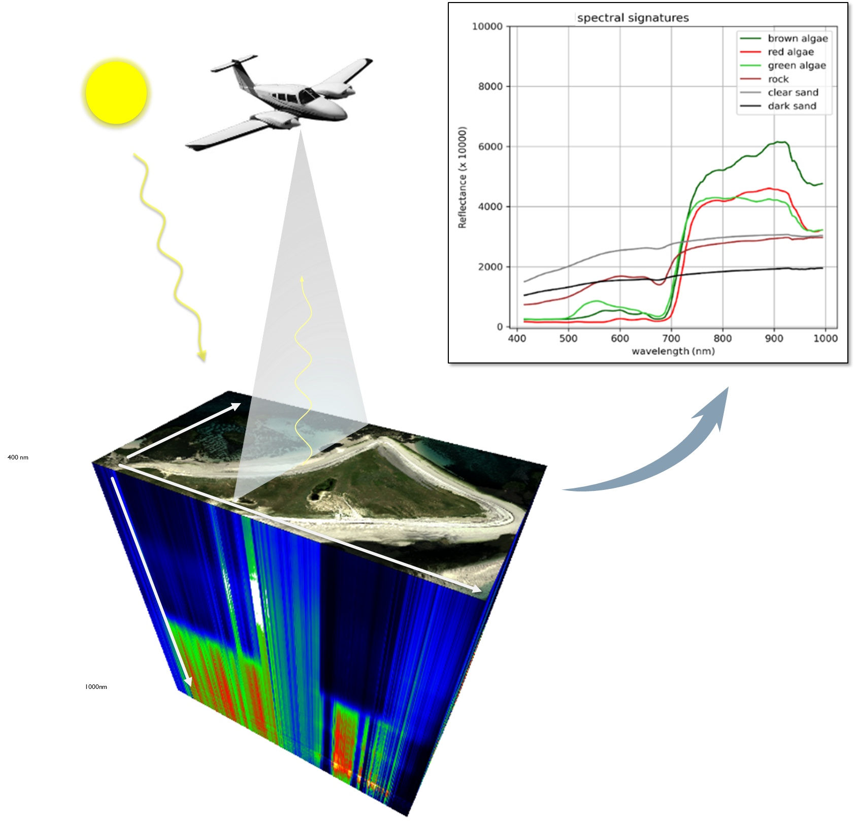
With Flyspec-Survey, benefit from a reliable hyperspectral imaging service that combines:
Accuracy
Flyspec guarantees fast, flexible, and wide-area acquisition of hyperspectral images with centimeter- to decimeter-level resolution, particularly in areas that are difficult to access by land or sea.
Quality
Image quality is ensured through ground-based and in-flight calibration tests. The images, delivered at various levels of processing, undergo systematic quality control.
Reliability
We also collect and utilize spectral libraries in the field (ground-based reflectance measurements on reference surfaces) that are useful for the analysis phase.
With Flyspec-Analysis, get hyperspectral image analysis services tailored to your specific needs, including:
Image delivery
Images are delivered orthorectified, georeferenced, and calibrated for sensor luminance and ground reflectance. The steps of radiometric and atmospheric correction of raw images, followed by georeferencing, mosaicking, and tiling, provide continuous spatial coverage that can be integrated into your GIS tools and is immediately available for your own analyses.
Mapping Services
We provide maps of plant species or substrates (e.g., algae, critical minerals), as well as features detected on the ground in terrestrial environments or shallow aquatic environments (e.g., archaeological structures, exposed targets).
Many environmental applications
Why Choose Flyspec?
Comprehensive expertise: acquisition, preprocessing, processing, mapping, and distribution
Reliability and accuracy: rigorous calibration and preprocessing, consistency with field measurements
Flexibility: a scalable solution tailored to your needs, areas, and platforms
Continuous innovation: integration of the latest hyperspectral, GIS, and artificial intelligence methods
They use Flyspec



Hytech-imaging
Airborne hyperspectral LiDAR solution for environmental monitoring
Conducted between 2022 and 2025 in partnership with ENSTA and SensUp, the Calhyb project enabled the development of a prototype aerial system combining LiDAR and hyperspectral technology, its testing under real-world conditions on an aircraft, and the analysis of the bathymetric and seabed composition data acquired by the system.
Following this project, Hytech-imaging aims to expand the service’s scope of application to include the detection of above-water targets for defense applications; and to consolidate the results obtained for hydrographic and environmental mapping in the civilian sector.
Calhyb received support from the AID, the Ministry of the Armed Forces / DGA-TN, and the Orion cluster.
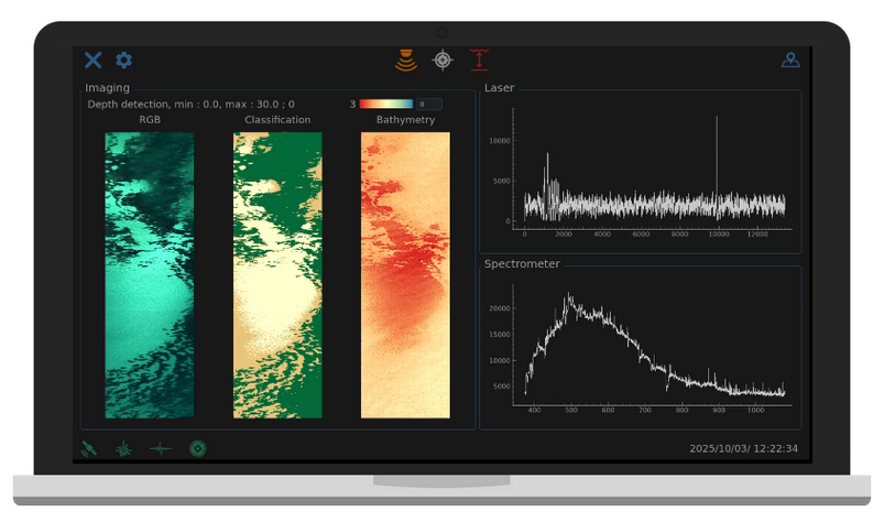
Real-time monitoring interface for seabed characteristics and bathymetry aboard the aircraft – ©Hytech-imaging



 English
  French